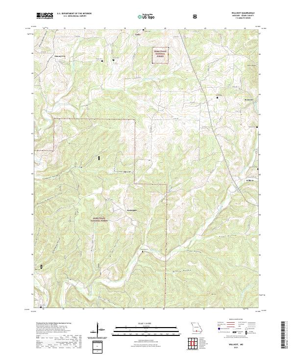
2021 Map of Willhoit
USGS Topo · Published 2021About this map
Willhoit and the surrounding Ozark County landscape are defined by a dense network of hollows and ridges within the Mark Twain National Forest. The map documents a rural settlement pattern where small communities like Romance, Nottinghill, and Summit City are connected by winding county roads such as Co RD 830 and State Hwy Z. The geography is intricately carved by watercourses, including Turkey Cr, Barren Fork, and S Fork Turkey Cr, which create the deep valleys for which this region is known.
Find a feature on this map
64 named features on this map. Tap any name to fly to it.
Don’t see what you’re looking for? This feature index may not catch every label — zoom into the map to look around manually.
Map Details
Editions of this 2021 Willhoit Map
This is the sole edition of this map. No revisions or reprints were ever made.
Other maps of this area

1934 · Gainesville
USGS Topo · 1:48,000

1936 · Thornfield
USGS Topo · 1:48,000

1936 · Ava
USGS Topo · 1:48,000

1937 · Buckhart
USGS Topo · 1:48,000

1940 · Gainesville
USGS Topo · 1:62,500

1942 · Ava
USGS Topo · 1:62,500

1943 · Thornfield
USGS Topo · 1:62,500

1943 · Buckhart
USGS Topo · 1:62,500

1945 · Ava
USGS Topo · 1:62,500

1945 · Harrison
USGS Topo · 1:250,000