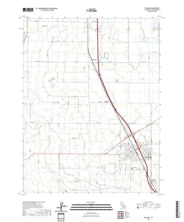
2022 Map of Williams
USGS Topo · Published 2022About this map
Williams serves as the hub of this agricultural landscape within the Sacramento Valley, where the grid of the city meets a complex network of irrigation and drainage. The Glenn-Colusa Canal and Glenn Valley Slough are critical components of the water management system that defines the Central Valley economy. Local history is anchored at the Williams Cem and at rural sidings like Cortena and Delphos, which speak to the area's development as a transport corridor for crops. Natural watercourses such as Lurline Cr, Freshwater Cr, and Salt Cr meander across the surveyed sections, often intersecting with local thoroughfares like Lurline Ave and Gibson Rd. This recent survey captures the modern road network, from the numbered streets of the town center to the expansive farm-to-market routes that support the surrounding fields.
Find a feature on this map
98 named features on this map. Tap any name to fly to it.
Don’t see what you’re looking for? This feature index may not catch every label — zoom into the map to look around manually.
Map Details
Editions of this 2022 Williams Map
This is the sole edition of this map. No revisions or reprints were ever made.
Other maps of this area

1904 · Sites
USGS Topo · 1:24,000

1905 · Fairview
USGS Topo · 1:24,000

1906 · Maxwell
USGS Topo · 1:62,500

1907 · Colusa
USGS Topo · 1:62,500

1917 · Compton Landing
USGS Topo · 1:31,680

1917 · Sites
USGS Topo · 1:31,680

1917 · Delevan
USGS Topo · 1:31,680

1918 · Williams
USGS Topo · 1:31,680

1918 · Spring Valley
USGS Topo · 1:31,680
1918 · Arbuckle
USGS Topo · 1:31,680