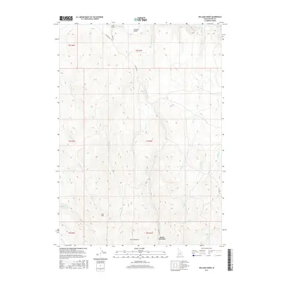
2017 Map of Williams Creek
USGS Topo · Published 2017About this map
South Mountain dominates the southern reaches of this Owyhee County landscape, where the high-altitude terrain is carved by a complex network of drainage basins. The area north of the peak is defined by the convergence of Williams Creek, West Cr, and Pole Bridge Cr, which flow through steep topography toward the more open expanse of Pleasant Valley. These watercourses reveal the historical importance of water access in this high-desert region, supporting ranching and early mining interests. Evidence of former mineral exploration is recorded in the naming of Iron Mine Cr and Minear Cr, while the northern border is marked by the course of Jordan Creek. Transportation through this isolated mountain range relies on the winding path of S Mountain Rd, which follows the natural contours of the land past Glass Gulch and Jims Peak.
Find a feature on this map
29 named features on this map. Tap any name to fly to it.
Don’t see what you’re looking for? This feature index may not catch every label — zoom into the map to look around manually.
Map Details
Editions of this 2017 Williams Creek Map
This is the sole edition of this map. No revisions or reprints were ever made.
Other maps of this area

1955 · Jordan Valley
USGS Topo · 1:250,000

1957 · Jordan Valley
USGS Topo · 1:250,000

1958 · Jordan Valley
USGS Topo · 1:250,000

1965 · Flint Creek
USGS Topo · 1:62,500
1969 · Jordan Valley
USGS Topo · 1:24,000

1973 · Indian Meadows
USGS Topo · 1:24,000

1973 · Cliffs
USGS Topo · 1:24,000

1980 · Juniper Point
USGS Topo · 1:24,000
1990 · Triangle
USGS Topo · 1:100,000
1990 · Flint
USGS Topo · 1:24,000