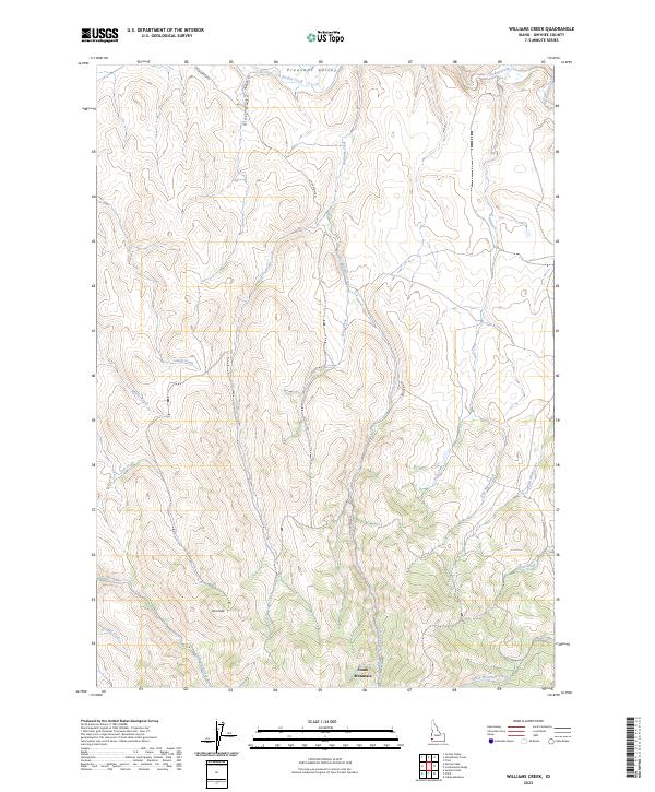
2023 Map of Williams Creek
USGS Topo · Published 2023About this map
Pleasant Valley and the high-elevation terrain of South Mountain anchor this modern-era study of Owyhee County. The landscape is defined by a dense network of drainage systems, including the northern flow of Jordan Creek and the western descent of Toppin Creek. The presence of Iron Mine Creek and Minear Creek suggests a history of prospecting and resource extraction in the high ridges surrounding Jims Peak. Settlement is sparse, with primary access limited to primitive routes like S Mountain Rd and Morgan Ln. The map offers a precise view of the complex hydrology between Big Boulder Creek and the southern slopes where South Mountain Creek originates, providing an essential resource for those tracing land use and topography in this remote stretch of Idaho.
Find a feature on this map
27 named features on this map. Tap any name to fly to it.
Don’t see what you’re looking for? This feature index may not catch every label — zoom into the map to look around manually.
Map Details
Editions of this 2023 Williams Creek Map
This is the sole edition of this map. No revisions or reprints were ever made.
Other maps of this area

1955 · Jordan Valley
USGS Topo · 1:250,000

1957 · Jordan Valley
USGS Topo · 1:250,000

1958 · Jordan Valley
USGS Topo · 1:250,000

1965 · Flint Creek
USGS Topo · 1:62,500
1969 · Jordan Valley
USGS Topo · 1:24,000

1973 · Indian Meadows
USGS Topo · 1:24,000

1973 · Cliffs
USGS Topo · 1:24,000

1980 · Juniper Point
USGS Topo · 1:24,000
1990 · Triangle
USGS Topo · 1:100,000
1990 · Flint
USGS Topo · 1:24,000