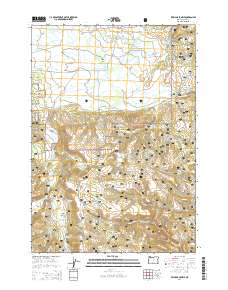
2014 Map of Williams Prairie
USGS Topo · Published 2014About this map
Big Summit Prairie and Williams Prairie anchor this high-elevation landscape within the Ochoco National Forest of central Oregon. The topography is defined by a series of distinct upland meadows and grazing grounds, including Antler Prairie, Long Prairie, and Round Prairie, which are connected by a network of forest development roads such as Fox Reservoir Rd and S Boundary Rd. The hydrology is equally complex, characterized by numerous small reservoirs and springs like Gill Reservoir, Bruner Spring Reservoir, and Berkley Spring, which feed into the N Fork Crooked River. This 2014 survey documents a landscape managed for both its water resources and seasonal grazing, with family-named features like Arvid Nelson Rd and Hickey Meadow reflecting the local history of land use and human presence in the Ochoco mountains.
Find a feature on this map
65 named features on this map. Tap any name to fly to it.
Don’t see what you’re looking for? This feature index may not catch every label — zoom into the map to look around manually.
Map Details
Editions of this 2014 Williams Prairie Map
This is the sole edition of this map. No revisions or reprints were ever made.
Other maps of this area

1951 · Post
USGS Topo · 1:62,500

1951 · Lookout Mtn
USGS Topo · 1:62,500

1955 · Bend
USGS Topo · 1:250,000

1957 · Bend
USGS Topo · 1:250,000

1958 · Bend
USGS Topo · 1:250,000

1965 · Williams Prairie
USGS Topo · 1:24,000

1966 · Keys Creek
USGS Topo · 1:24,000

1966 · Peterson Point
USGS Topo · 1:24,000

1966 · Mt. Pisgah
USGS Topo · 1:24,000

1981 · Prineville
USGS Topo · 1:100,000