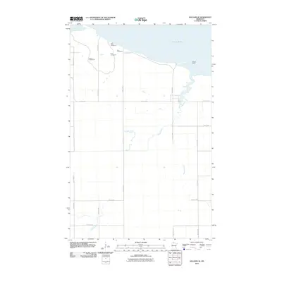
2010 Map of Williams SE
USGS Topo · Published 2010About this map
Morris Point and the southern shoreline of Lake of Woods anchor this northern Minnesota landscape near the turn of the 21st century. The map depicts a region defined by its relationship with the water, where the vast lake recedes into Zippel Bay and several drainage systems like Bostick Creek, Wabanica Creek, and Canfield Creek snake across the low-lying terrain. The transition from the water's edge to the interior is marked by a cluster of seasonal sites, including Lady's-slipper Campground, Birch Campground, Ridge Campground, and Angler's Campground, suggesting a local economy and culture heavily centered on lake-access recreation. A grid of county highways and rural avenues, such as County Hwy-4 and County Hwy-8, provides the primary structure for the scattered settlements and agricultural plots that fill the spaces between the wetlands and the shore.
Find a feature on this map
23 named features on this map. Tap any name to fly to it.
Don’t see what you’re looking for? This feature index may not catch every label — zoom into the map to look around manually.
Map Details
Editions of this 2010 Williams SE Map
This is the sole edition of this map. No revisions or reprints were ever made.
Other maps of this area

1918 · Williams
USGS Topo · 1:62,500

1919 · Peppermint Creek
USGS Topo · 1:62,500

1919 · Canada
USGS Topo · 1:62,500

1921 · Baudette
USGS Topo · 1:62,500

1943 · Peppermint Creek
USGS Topo · 1:62,500

1954 · Roseau
USGS Topo · 1:250,000

1957 · Roseau
USGS Topo · 1:250,000

1958 · Roseau
USGS Topo · 1:250,000

1967 · Williams
USGS Topo · 1:24,000
1967 · Williams NW
USGS Topo · 1:24,000