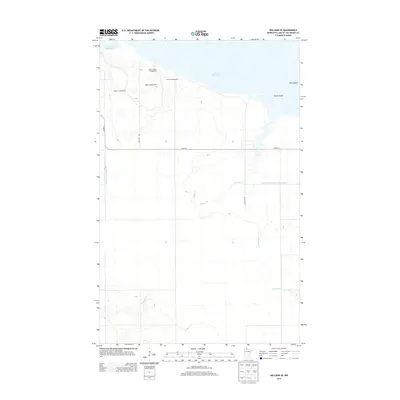
2013 Map of Williams SE
USGS Topo · Published 2013About this map
The southern shoreline of Lake of the Woods dominates this portion of Lake of the Woods County, where the landscape transitions from the vast water body to a network of managed drainage and recreation sites. Along the lakefront, specialized areas like Lady's-slipper Campground, Angler's Campground, and Ridge Campground suggest a long-standing local economy centered on seasonal sport fishing and outdoor tourism. Moving inland, the natural hydrology of Bostick Cr and Wabanica Cr is augmented by an extensive system of man-made waterways, including County Ditch Number One and the formally designated Judicial Ditch Number Twentyeight. This grid-like hydrological infrastructure, intersecting with roads like Co HWY-8, highlights the historical effort to manage the low-lying terrain for regional development. Landmarks such as Morris Point and Pine Island further define the coastal geography at the northern edge of this survey.
Find a feature on this map
15 named features on this map. Tap any name to fly to it.
Don’t see what you’re looking for? This feature index may not catch every label — zoom into the map to look around manually.
Map Details
Editions of this 2013 Williams SE Map
This is the sole edition of this map. No revisions or reprints were ever made.
Other maps of this area

1918 · Williams
USGS Topo · 1:62,500

1919 · Peppermint Creek
USGS Topo · 1:62,500

1919 · Canada
USGS Topo · 1:62,500

1921 · Baudette
USGS Topo · 1:62,500

1943 · Peppermint Creek
USGS Topo · 1:62,500

1954 · Roseau
USGS Topo · 1:250,000

1957 · Roseau
USGS Topo · 1:250,000

1958 · Roseau
USGS Topo · 1:250,000

1967 · Williams
USGS Topo · 1:24,000
1967 · Williams NW
USGS Topo · 1:24,000