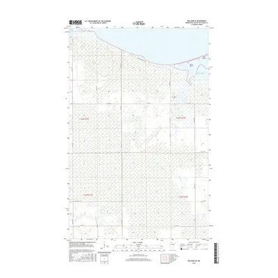
2016 Map of Williams SE
USGS Topo · Published 2016About this map
Morris Point and Pine Island define the transition where the expansive lowlands of Lake of the Woods County meet the southern waters of the Great Lake of the North. This 2016 survey illustrates a landscape dominated by vast wetland complexes and interior drainage systems like Bostick Creek and Wabanica Creek, which feed into Fourmile Bay. The map captures a contemporary look at the rural section line roads, such as Co HWY 8 and Co HWY 4, that navigate this saturated terrain. The northern shoreline, including Zippel Bay and the corridor along Graceton Beach Rd NW, highlights the area's significance for seasonal residency and water access, while the interior remains a testament to the resilient, boggy geography characteristic of the Minnesota borderlands.
Find a feature on this map
31 named features on this map. Tap any name to fly to it.
Don’t see what you’re looking for? This feature index may not catch every label — zoom into the map to look around manually.
Map Details
Editions of this 2016 Williams SE Map
This is the sole edition of this map. No revisions or reprints were ever made.
Other maps of this area

1918 · Williams
USGS Topo · 1:62,500

1919 · Peppermint Creek
USGS Topo · 1:62,500

1919 · Canada
USGS Topo · 1:62,500

1921 · Baudette
USGS Topo · 1:62,500

1943 · Peppermint Creek
USGS Topo · 1:62,500

1954 · Roseau
USGS Topo · 1:250,000

1957 · Roseau
USGS Topo · 1:250,000

1958 · Roseau
USGS Topo · 1:250,000

1967 · Williams
USGS Topo · 1:24,000
1967 · Williams NW
USGS Topo · 1:24,000