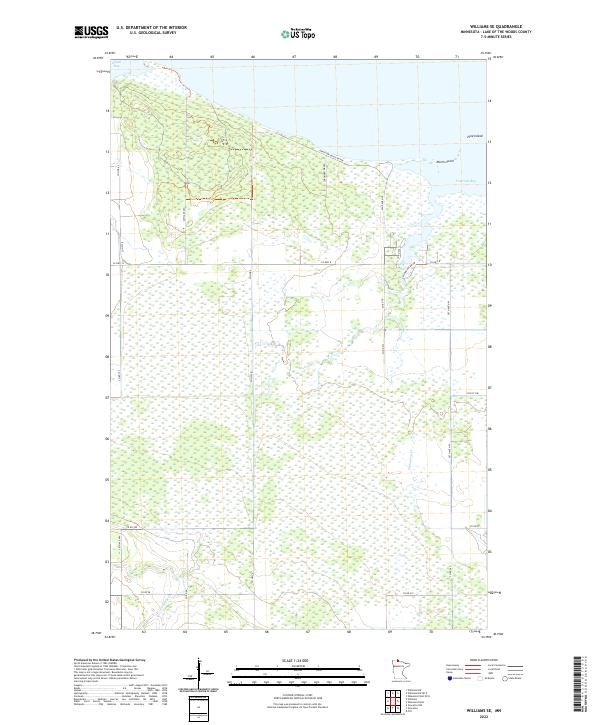
2022 Map of Williams SE
USGS Topo · Published 2022About this map
Zippel Bay and Fourmile Bay define the northern shoreline of this Lake of the Woods landscape, where the water meets a low-lying expanse of wetlands and small drainage systems. The coastline is marked by distinctive points like Morris Point and the narrow stretch of Pine Island, which shelter the inner bays from the open lake. Moving inland, the terrain is defined by a grid of county roads and numerous small watercourses, including Wabanica Cr, Bostick Cr, and Canfield Cr. This network of waterways suggests a complex drainage pattern essential for the surrounding acreage. The concentration of local routes like Graceton Beach Rd NW and Ken Mar Kee Dr NW near the shore indicates a landscape primarily utilized for coastal access and rural homesteads, maintaining a quiet, dispersed settlement pattern characteristic of northern Minnesota.
Find a feature on this map
32 named features on this map. Tap any name to fly to it.
Don’t see what you’re looking for? This feature index may not catch every label — zoom into the map to look around manually.
Map Details
Editions of this 2022 Williams SE Map
This is the sole edition of this map. No revisions or reprints were ever made.
Other maps of this area

1918 · Williams
USGS Topo · 1:62,500

1919 · Peppermint Creek
USGS Topo · 1:62,500

1919 · Canada
USGS Topo · 1:62,500

1921 · Baudette
USGS Topo · 1:62,500

1943 · Peppermint Creek
USGS Topo · 1:62,500

1954 · Roseau
USGS Topo · 1:250,000

1957 · Roseau
USGS Topo · 1:250,000

1958 · Roseau
USGS Topo · 1:250,000

1967 · Williams
USGS Topo · 1:24,000
1967 · Williams NW
USGS Topo · 1:24,000