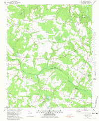
1980 Map of Williams
USGS Topo · Published 1981About this map
Cliffs of the Neuse State Park and the winding Neuse River dominate the northern landscape of this region along the Wayne and Duplin County line. The terrain transitions from the river bluffs into the dense wetlands of Horsepen Pocosin and the curiously named Devils Woodyard. This 1980 survey reveals a rural landscape deeply rooted in small crossroads communities like Indian Springs, Pricetown, and Hines Crossroads, which are connected by a network of drainage branches including Cabin Br and Jumping Run Branch.
Find a feature on this map
67 named features on this map. Tap any name to fly to it.
Don’t see what you’re looking for? This feature index may not catch every label — zoom into the map to look around manually.
Map Details
Editions of this 1980 Williams Map
2 editions found
Other maps of this area

1953 · Rocky Mount
USGS Topo · 1:250,000

1953 · Raleigh
USGS Topo · 1:250,000

1954 · Rocky Mount
USGS Topo · 1:250,000

1954 · Raleigh
USGS Topo · 1:250,000

1957 · Goldsboro
USGS Topo · 1:62,500

1957 · Seven Springs
USGS Topo · 1:62,500

1974 · Southwest Goldsboro
USGS Topo · 1:24,000
1977 · Warsaw North
USGS Topo · 1:24,000
1977 · Mount Olive
USGS Topo · 1:24,000

1980 · Seven Springs
USGS Topo · 1:24,000