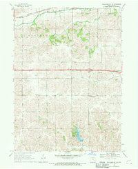
1968 Map of Williamsburg NW
USGS Topo · Published 1970About this map
Big Bear Creek and Little Bear Creek dominate the northern landscape of Iowa County, where the Chicago Rock Island and Pacific railroad traces the valley floor. The map documents a transition in rural infrastructure during the late 1960s, notably featuring the 4 Lane interstate highway and its associated rest area cutting through the center of Hartford and Sumner townships.
Find a feature on this map
24 named features on this map. Tap any name to fly to it.
Don’t see what you’re looking for? This feature index may not catch every label — zoom into the map to look around manually.
Map Details
Editions of this 1968 Williamsburg NW Map
This is the sole edition of this map. No revisions or reprints were ever made.
Other maps of this area

1954 · Des Moines
USGS Topo · 1:250,000

1956 · Des Moines
USGS Topo · 1:250,000

1957 · Des Moines
USGS Topo · 1:250,000

1965 · Ladora
USGS Topo · 1:24,000
1965 · Marengo
USGS Topo · 1:24,000

1968 · Deep River
USGS Topo · 1:24,000
1968 · North English
USGS Topo · 1:24,000
1968 · Williamsburg
USGS Topo · 1:24,000

1968 · Victor
USGS Topo · 1:24,000

1968 · Hartwick
USGS Topo · 1:24,000