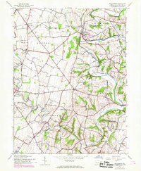
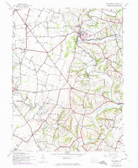
1944 Map of Williamson
USGS Topo · Published 1969About this map
The winding course of Conococheague Creek and its many tributaries, such as Back Creek and Licking Creek, define the rural landscape of Franklin County. This mid-century survey illustrates a dense network of country roads connecting small settlements like Williamson, Lemasters, and Welsh Run. A high concentration of rural education sites is evident, with named institutions including Franklin Sch, Highland Sch, and Rising Sun Sch serving the farming communities. The Penn Central rail line cuts across the northern landscape through Rockdale, while Baker Caverns provides a distinct geological landmark west of the main creek. The map reflects a period of transition, with 1960s-era revisions shown in purple that highlight new residential developments and structural changes against the established 1940s agricultural backdrop.
Find a feature on this map
29 named features on this map. Tap any name to fly to it.
Don’t see what you’re looking for? This feature index may not catch every label — zoom into the map to look around manually.
Map Details
Editions of this 1944 Williamson Map
5 editions found
Other maps of this area

1900 · Mercersburg
USGS Topo · 1:62,500

1902 · Chambersburg
USGS Topo · 1:62,500

1902 · Mercersburg
USGS Topo · 1:62,500

1909 · Hagerstown
USGS Topo · 1:48,000

1912 · Hagerstown
USGS Topo · 1:62,500

1912 · Williamsport
USGS Topo · 1:62,500

1942 · Hagerstown
USGS Topo · 1:125,000

1943 · Hagerstown
USGS Topo · 1:125,000

1943 · Mercersburg
USGS Topo · 1:24,000

1943 · Chambersburg
USGS Topo · 1:62,500
Featured Places
- Hamilton Township, PA
- Antrim Township, PA
- Williamson, St. Thomas Township
- Vanilla, Montgomery Township
- Rockdale, Peters Township