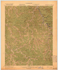
1918 Map of Williamson
USGS Topo · Published 1918About this map
Williamson and its neighboring coal-country settlements line the banks of the Tug Fork river, which serves as the winding boundary between Kentucky and West Virginia. This 1918 edition, based on surveys from 1909 and 1915, documents the industrial landscape dominated by the Norfolk and Western RR as it snakes through the valley connecting Nolan, Chattaroy, and East Williamson. The surrounding ridges, including portions of Hardee and Lee, are dissected by numerous creeks and hollows where small rural schools like Hammon Manor School and Dicks Fork School once served isolated mountain communities.
Find a feature on this map
144 named features on this map. Tap any name to fly to it.
Don’t see what you’re looking for? This feature index may not catch every label — zoom into the map to look around manually.
Map Details
Editions of this 1918 Williamson Map
3 editions found
Other maps of this area

1886 · Prestonsburg
USGS Topo · 1:125,000

1886 · Grundy
USGS Topo · 1:125,000

1887 · Warfield
USGS Topo · 1:125,000

1890 · Whitesburg
USGS Topo · 1:125,000

1890 · Grundy
USGS Topo · 1:125,000

1891 · Warfield
USGS Topo · 1:125,000

1892 · Grundy
USGS Topo · 1:125,000

1892 · Whitesburg
USGS Topo · 1:125,000

1892 · Prestonsburg
USGS Topo · 1:125,000

1909 · Matewan
USGS Topo · 1:48,000