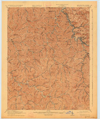
1918 Map of Williamson
USGS Topo · Published 1927About this map
Tug Fork serves as the winding boundary between Kentucky and West Virginia, anchoring a landscape defined by sharp ridges and deep coal-country hollows. At the heart of this region, Williamson and East Williamson sit along the Norfolk and Western Ry, which follows the riverbank through industrial outposts like Borderland, Goodman, and Nolan. This 1910s era survey captures the early 20th-century density of the Tug River Valley, where rail lines and settlements are squeezed into the narrow valleys.
Find a feature on this map
75 named features on this map. Tap any name to fly to it.
Don’t see what you’re looking for? This feature index may not catch every label — zoom into the map to look around manually.
Map Details
Editions of this 1918 Williamson Map
3 editions found
Other maps of this area

1886 · Prestonsburg
USGS Topo · 1:125,000

1886 · Grundy
USGS Topo · 1:125,000

1887 · Warfield
USGS Topo · 1:125,000

1890 · Whitesburg
USGS Topo · 1:125,000

1890 · Grundy
USGS Topo · 1:125,000

1891 · Warfield
USGS Topo · 1:125,000

1892 · Grundy
USGS Topo · 1:125,000

1892 · Whitesburg
USGS Topo · 1:125,000

1892 · Prestonsburg
USGS Topo · 1:125,000

1909 · Matewan
USGS Topo · 1:48,000