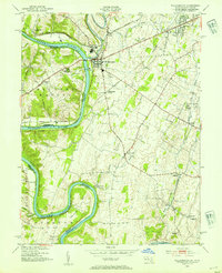
1953 Map of Williamsport
USGS Topo · Published 1954About this map
Williamsport serves as the focal point of this 1953 survey, where the confluence of Conococheague Creek and the Potomac River historically dictated the region's transport patterns. The industrial and transit legacy of Washington County is clearly visible, featuring the path of the Chesapeake and Ohio Canal paralleling the river's winding bends, including Powell and Whitings Neck. This era of the mid-20th century shows the established rail infrastructure of the Western Maryland and Norfolk and Western lines serving settlements like Pinesburg Sta and Kemps. Further inland, the map transitions to a landscape of rural hamlets and institutions, from the school at St James Sch to the quiet crossroads of Downsville and Bakersville, providing a detailed look at the small-town Maryland and West Virginia borderlands before the era of major suburban expansion.
Find a feature on this map
39 named features on this map. Tap any name to fly to it.
Don’t see what you’re looking for? This feature index may not catch every label — zoom into the map to look around manually.
Map Details
Editions of this 1953 Williamsport Map
4 editions found
Other maps of this area

1884 · Harpers Ferry
USGS Topo · 1:125,000

1891 · Harpers Ferry
USGS Topo · 1:125,000

1893 · Harpers Ferry
USGS Topo · 1:125,000

1908 · Middletown
USGS Topo · 1:48,000

1909 · Hagerstown
USGS Topo · 1:48,000

1910 · Antietam
USGS Topo · 1:62,500

1912 · Hagerstown
USGS Topo · 1:62,500

1912 · Williamsport
USGS Topo · 1:62,500

1914 · Martinsburg
USGS Topo · 1:48,000

1916 · Martinsburg
USGS Topo · 1:62,500