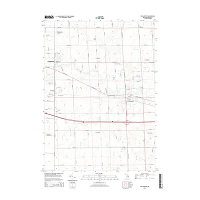
2014 Map of Williamston
USGS Topo · Published 2014About this map
The Red Cedar River defines the central corridor of this Ingham County landscape, winding past the burgeoning communities of Okemos and Williamston. The area reflects a transition from traditional agricultural plots to suburban expansion, yet it maintains deep roots through its many small burial grounds. Genealogists can find several key sites including Saint Katherine's Episcopal Cem, Foote Cem, and Mt Calvary Cem. In the northwest, the settlement of Haslett sits near the upper reaches of the map, while Maidens Airport serves as a local aviation landmark. The network of rural roads, such as Haslett Rd and Germany Rd, connects these residential hubs to the surrounding townships of T4N R1E and T3N R1E. Smaller waterways like Coon Cr, Bullet Drain, and Deer Cr weave through the terrain, illustrating the local drainage patterns that have historically shaped the development of this Michigan interior.
Find a feature on this map
83 named features on this map. Tap any name to fly to it.
Don’t see what you’re looking for? This feature index may not catch every label — zoom into the map to look around manually.
Map Details
Editions of this 2014 Williamston Map
This is the sole edition of this map. No revisions or reprints were ever made.
Other maps of this area

1908 · Fowlerville
USGS Topo · 1:62,500

1909 · Mason
USGS Topo · 1:62,500

1910 · Fowlerville
USGS Topo · 1:62,500

1911 · Mason
USGS Topo · 1:62,500

1926 · Corunna
USGS Topo · 1:62,500

1928 · Laingsburg
USGS Topo · 1:62,500

1929 · Corunna
USGS Topo · 1:62,500

1944 · Laingsburg
USGS Topo · 1:62,500

1944 · Corunna
USGS Topo · 1:62,500

1958 · Grand Rapids
USGS Topo · 1:250,000