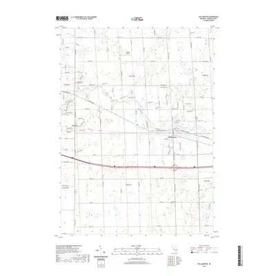
2019 Map of Williamston
USGS Topo · Published 2019About this map
The Red Cedar River flows through the heart of this Ingham County landscape, linking the growing community of Williamston with the residential and agricultural land to the west. This 2019 survey documents a region defined by a mix of historic rural landmarks and modern suburban development. Genealogists will find a high density of burial grounds throughout the area, including Saint Katherine's Episcopal Cem, Foote Cem, and Mount Calvary Cem near the town center. The landscape is drained by a network of waterways such as Sloan Cr, Deer Cr, and the industrial-sounding Bullet Drain. Significant local transit corridors like W Grand River Ave and Linn Rd intersect the terrain, while the presence of Maidens Airport northwest of the river provides a point of interest for aviation history. The survey captures the subtle topography near Meridian, where new subdivisions like Chimney Oaks Dr meet established rural roads.
Find a feature on this map
64 named features on this map. Tap any name to fly to it.
Don’t see what you’re looking for? This feature index may not catch every label — zoom into the map to look around manually.
Map Details
Editions of this 2019 Williamston Map
This is the sole edition of this map. No revisions or reprints were ever made.
Other maps of this area

1908 · Fowlerville
USGS Topo · 1:62,500

1909 · Mason
USGS Topo · 1:62,500

1910 · Fowlerville
USGS Topo · 1:62,500

1911 · Mason
USGS Topo · 1:62,500

1926 · Corunna
USGS Topo · 1:62,500

1928 · Laingsburg
USGS Topo · 1:62,500

1929 · Corunna
USGS Topo · 1:62,500

1944 · Laingsburg
USGS Topo · 1:62,500

1944 · Corunna
USGS Topo · 1:62,500

1958 · Grand Rapids
USGS Topo · 1:250,000