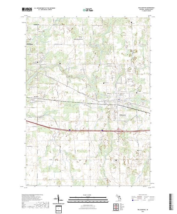
2023 Map of Williamston
USGS Topo · Published 2023About this map
The Red Cedar River meanders eastward through Ingham County, anchoring a landscape that bridges the suburban growth of Okemos and Haslett with the more established town center of Williamston. This 2023 survey provides a contemporary perspective on the region's historical layout, preserving the location of numerous small burial grounds such as Brick Cem and Foote Cem that predate the modern residential expansion. The network of rural roads, including Haslett Rd and Germany Rd, still follows the traditional township grid system even as new developments like Wind N Wood Dr begin to fill the spaces between traditional agricultural tracts.
Find a feature on this map
99 named features on this map. Tap any name to fly to it.
Don’t see what you’re looking for? This feature index may not catch every label — zoom into the map to look around manually.
Map Details
Editions of this 2023 Williamston Map
This is the sole edition of this map. No revisions or reprints were ever made.
Other maps of this area

1908 · Fowlerville
USGS Topo · 1:62,500

1909 · Mason
USGS Topo · 1:62,500

1910 · Fowlerville
USGS Topo · 1:62,500

1911 · Mason
USGS Topo · 1:62,500

1926 · Corunna
USGS Topo · 1:62,500

1928 · Laingsburg
USGS Topo · 1:62,500

1929 · Corunna
USGS Topo · 1:62,500

1944 · Laingsburg
USGS Topo · 1:62,500

1944 · Corunna
USGS Topo · 1:62,500

1958 · Grand Rapids
USGS Topo · 1:250,000