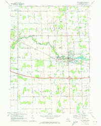
1970 Map of Williamston
USGS Topo · Published 1973About this map
The city of Williamston serves as the focal point of this central Michigan landscape, where the Red Cedar River meanders through the townships of Williamstown and Wheatfield. Transportation corridors define the area's development, with the Chesapeake and Ohio railroad running parallel to the river, supporting the local economy. Rural life is well-documented through numerous family and community landmarks, including the Wheatfield Ch and several country burying grounds such as Summit Cemetery and Brick Cem.
Find a feature on this map
74 named features on this map. Tap any name to fly to it.
Don’t see what you’re looking for? This feature index may not catch every label — zoom into the map to look around manually.
Map Details
Editions of this 1970 Williamston Map
This is the sole edition of this map. No revisions or reprints were ever made.
Other maps of this area

1908 · Fowlerville
USGS Topo · 1:62,500

1909 · Mason
USGS Topo · 1:62,500

1910 · Fowlerville
USGS Topo · 1:62,500

1911 · Mason
USGS Topo · 1:62,500

1926 · Corunna
USGS Topo · 1:62,500

1928 · Laingsburg
USGS Topo · 1:62,500

1929 · Corunna
USGS Topo · 1:62,500

1944 · Laingsburg
USGS Topo · 1:62,500

1944 · Corunna
USGS Topo · 1:62,500

1958 · Grand Rapids
USGS Topo · 1:250,000
Featured Places
- Williamston, MI
- Meridian Charter Township, MI
- Wheatfield Township, MI
- Meridian, MI
- Alaiedon Township, MI