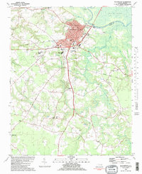
1982 Map of Williamston
USGS Topo · Published 1982About this map
Williamston serves as a vital river port and county seat along the south bank of the Roanoke River in this early 1980s portrait of Martin County. The town's layout reflects a transition from river-based trade to a modern rail-and-road economy, centered on the Seaboard Coast Line and institutions like Martin Community College. Beyond the urban core, the landscape is defined by its drainages, where Sweetwater Creek and Hardison Mill Creek cut through a patchwork of agricultural land and timber.
Find a feature on this map
55 named features on this map. Tap any name to fly to it.
Don’t see what you’re looking for? This feature index may not catch every label — zoom into the map to look around manually.
Map Details
Editions of this 1982 Williamston Map
This is the sole edition of this map. No revisions or reprints were ever made.
Other maps of this area

1901 · Williamston
USGS Topo · 1:62,500

1902 · Williamston
USGS Topo · 1:62,500

1903 · Chocowinity
USGS Topo · 1:62,500

1905 · Chocowinity
USGS Topo · 1:62,500

1943 · Plymouth
USGS Topo · 1:125,000

1953 · Rocky Mount
USGS Topo · 1:250,000

1954 · Rocky Mount
USGS Topo · 1:250,000
1978 · Farmlife
USGS Topo · 1:24,000
1978 · Jamesville
USGS Topo · 1:24,000

1978 · Windsor South
USGS Topo · 1:24,000