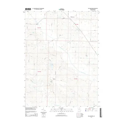
2014 Map of Williamstown
USGS Topo · Published 2014About this map
The North Fabius River and Middle Fabius River carve a meandering path through this Lewis County landscape, defining the topography surrounding the historic settlement of Williamstown. Long-standing rural communities are anchored by the presence of Williamstown Cemetery, Cecil Cemetery, and Morris Cemetery, which offer valuable geographic markers for genealogical research in this part of Northeast Missouri. The area is characterized by numerous small water bodies and drainage systems, including Deer Ridge Community Lake, Wurtzburger Lake, and Stice Lake.
Find a feature on this map
63 named features on this map. Tap any name to fly to it.
Don’t see what you’re looking for? This feature index may not catch every label — zoom into the map to look around manually.
Map Details
Editions of this 2014 Williamstown Map
This is the sole edition of this map. No revisions or reprints were ever made.
Other maps of this area

1903 · Kahoka
USGS Topo · 1:125,000

1949 · St. Patrick
USGS Topo · 1:24,000

1950 · Saint Patrick
USGS Topo · 1:24,000

1950 · Neeper
USGS Topo · 1:24,000

1950 · Benjamin
USGS Topo · 1:24,000

1950 · Williamstown
USGS Topo · 1:24,000

1950 · Lewistown
USGS Topo · 1:24,000

1950 · Colony
USGS Topo · 1:24,000
1950 · Monticello
USGS Topo · 1:24,000

1950 · La Belle
USGS Topo · 1:24,000