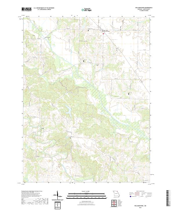
2021 Map of Williamstown
USGS Topo · Published 2021About this map
The Williamstown area of Lewis County is defined by the winding courses of the North Fabius River and the Middle Fabius River, which carve through the agricultural landscape of northeast Missouri. This survey reveals a region structured by a dense grid of county roads and several state routes, including State Hwy E and State Hwy A, which connect the small settlement of Williamstown to the surrounding farmsteads. Local history is anchored by several burial grounds situated near these arterial routes, such as Williamstown Cem, Cecil Cem, and Morris Cem. Small bodies of water like Catfish Lake and Stice Lake punctuate the drainage basins of the river system, which is further fed by numerous named tributaries including Sugar Cr, Buck Br, and Reddish Br. The map illustrates a contemporary rural environment where modern infrastructure follows long-established land divisions and natural watercourses.
Find a feature on this map
61 named features on this map. Tap any name to fly to it.
Don’t see what you’re looking for? This feature index may not catch every label — zoom into the map to look around manually.
Map Details
Editions of this 2021 Williamstown Map
This is the sole edition of this map. No revisions or reprints were ever made.
Other maps of this area

1903 · Kahoka
USGS Topo · 1:125,000

1949 · St. Patrick
USGS Topo · 1:24,000

1950 · Saint Patrick
USGS Topo · 1:24,000

1950 · Neeper
USGS Topo · 1:24,000

1950 · Benjamin
USGS Topo · 1:24,000

1950 · Williamstown
USGS Topo · 1:24,000

1950 · Lewistown
USGS Topo · 1:24,000

1950 · Colony
USGS Topo · 1:24,000
1950 · Monticello
USGS Topo · 1:24,000

1950 · La Belle
USGS Topo · 1:24,000