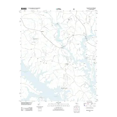
2012 Map of Willington
USGS Topo · Published 2012About this map
Bordeaux and Willington anchor this corner of McCormick County, where the landscape is defined by the vast waters of the J. Strom Thurmond Reservoir. The map shows a region shaped by modern recreation and subdivision growth, such as the Hickory Knob Subdivision, yet it remains deeply connected to its past through numerous family and community landmarks. Genealogists can locate several burial grounds, including the Willington Cemetery, Bordeaux Cemetery, and the more secluded Badwell Cemetery near the eastern edge.
Find a feature on this map
51 named features on this map. Tap any name to fly to it.
Don’t see what you’re looking for? This feature index may not catch every label — zoom into the map to look around manually.
Map Details
Editions of this 2012 Willington Map
This is the sole edition of this map. No revisions or reprints were ever made.
Other maps of this area

1892 · Mc Cormick
USGS Topo · 1:125,000

1892 · Abbeville
USGS Topo · 1:125,000

1893 · Elberton
USGS Topo · 1:125,000

1906 · Crawfordville
USGS Topo · 1:125,000

1912 · Mc Cormick
USGS Topo · 1:125,000

1948 · Verdery
USGS Topo · 1:24,000

1949 · Calhoun Creek
USGS Topo · 1:24,000

1950 · Verdery
USGS Topo · 1:24,000

1953 · Athens
USGS Topo · 1:250,000

1954 · Metasville
USGS Topo · 1:24,000