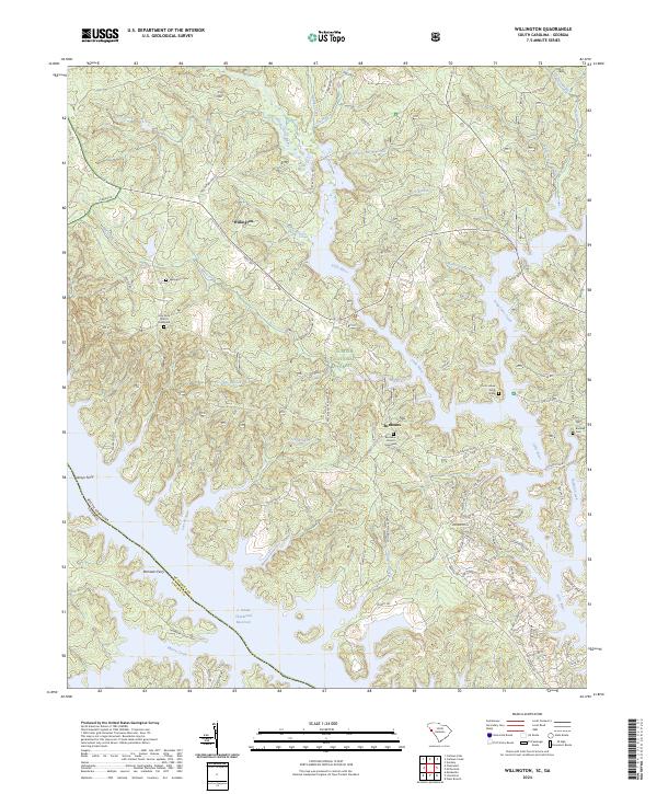
2024 Map of Willington
USGS Topo · Published 2024About this map
The waters of the J. Strom Thurmond Reservoir dominate the southwestern corner of this landscape, marking the border between South Carolina and Georgia. Along the eastern shores of these reservoir inlets, the settlements of Willington and Bordeaux maintain their historic presence amidst the timberlands of the Sumter National Forest. The map reveals a high concentration of genealogical sites, including the Willington Cem and the uniquely named De La Howe Tomb Grave. Cultural landmarks like the Holy Rock Church Graveyard and Bordeaux Church Graveyard are preserved alongside modern residential developments near the lake. The terrain is defined by a dense network of drainages such as Long Cane Creek and Little River, which flow toward the reservoir. Traces of older river-based transit remain visible through the labels for Leroys Ferry and Remsens Ferry, anchoring the modern map to its historical role as a river crossing point.
Find a feature on this map
81 named features on this map. Tap any name to fly to it.
Don’t see what you’re looking for? This feature index may not catch every label — zoom into the map to look around manually.
Map Details
Editions of this 2024 Willington Map
This is the sole edition of this map. No revisions or reprints were ever made.
Other maps of this area

1892 · Mc Cormick
USGS Topo · 1:125,000

1892 · Abbeville
USGS Topo · 1:125,000

1893 · Elberton
USGS Topo · 1:125,000

1906 · Crawfordville
USGS Topo · 1:125,000

1912 · Mc Cormick
USGS Topo · 1:125,000

1948 · Verdery
USGS Topo · 1:24,000

1949 · Calhoun Creek
USGS Topo · 1:24,000

1950 · Verdery
USGS Topo · 1:24,000

1953 · Athens
USGS Topo · 1:250,000

1954 · Metasville
USGS Topo · 1:24,000