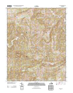
2013 Map of Willis
USGS Topo · Published 2013About this map
Mabry Mill and the Mabry Mill Pond anchor the southeastern corner of this Floyd County landscape, representing a vital piece of the region's rural heritage. The terrain is defined by a series of prominent peaks and ridges, including Buffalo Mountain, Slate Mountain, and Jones Mountain, which dictate the drainage patterns of waterways like Burks Fork and the W Fork Little River. Small settlements such as Willis, Union, and Conners Grove are connected by a network of winding mountain roads and hollows. The presence of Rock Castle Gap and various family-named features like Kyle Weeks Rd SW and Hylton Hollow RD SW provide specific points of interest for genealogists and local historians tracing the physical layout of these communities in the early 21st century.
Find a feature on this map
106 named features on this map. Tap any name to fly to it.
Don’t see what you’re looking for? This feature index may not catch every label — zoom into the map to look around manually.
Map Details
Editions of this 2013 Willis Map
This is the sole edition of this map. No revisions or reprints were ever made.
Other maps of this area

1889 · Hillsville
USGS Topo · 1:125,000

1892 · Hillsville
USGS Topo · 1:125,000

1896 · Hillsville
USGS Topo · 1:125,000

1928 · Stuart
USGS Topo · 1:48,000

1931 · Stuart
USGS Topo · 1:62,500

1953 · Winston-Salem
USGS Topo · 1:250,000

1955 · Winston-Salem
USGS Topo · 1:250,000

1956 · Macks Mountain
USGS Topo · 1:62,500

1957 · Mount Airy
USGS Topo · 1:62,500

1957 · Floyd
USGS Topo · 1:62,500