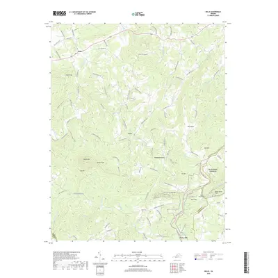
2019 Map of Willis
USGS Topo · Published 2019About this map
Mabry Mill and its associated Mabry Mill Pond anchor the southeastern corner of this landscape where the Floyd and Patrick County line meets. The terrain is defined by a dense network of high ridges and narrow creek valleys, including Buffalo Mtn and Slate Mtn. These peaks divide numerous watercourses such as Burks Fork and Laurel Fork, which carve through the highlands. Small settlements like Willis and Union are connected by a web of winding roads, including Willis Mill Rd NW and Union School Rd SW, reflecting the area's rural development pattern. The presence of the Blue Ridge Parkway winding through Rock Castle Gap and the Shelor Cem provides specific points of interest for genealogists and local historians documenting the habitation of this portion of the Blue Ridge Mountains.
Find a feature on this map
101 named features on this map. Tap any name to fly to it.
Don’t see what you’re looking for? This feature index may not catch every label — zoom into the map to look around manually.
Map Details
Editions of this 2019 Willis Map
This is the sole edition of this map. No revisions or reprints were ever made.
Other maps of this area

1889 · Hillsville
USGS Topo · 1:125,000

1892 · Hillsville
USGS Topo · 1:125,000

1896 · Hillsville
USGS Topo · 1:125,000

1928 · Stuart
USGS Topo · 1:48,000

1931 · Stuart
USGS Topo · 1:62,500

1953 · Winston-Salem
USGS Topo · 1:250,000

1955 · Winston-Salem
USGS Topo · 1:250,000

1956 · Macks Mountain
USGS Topo · 1:62,500

1957 · Mount Airy
USGS Topo · 1:62,500

1957 · Floyd
USGS Topo · 1:62,500