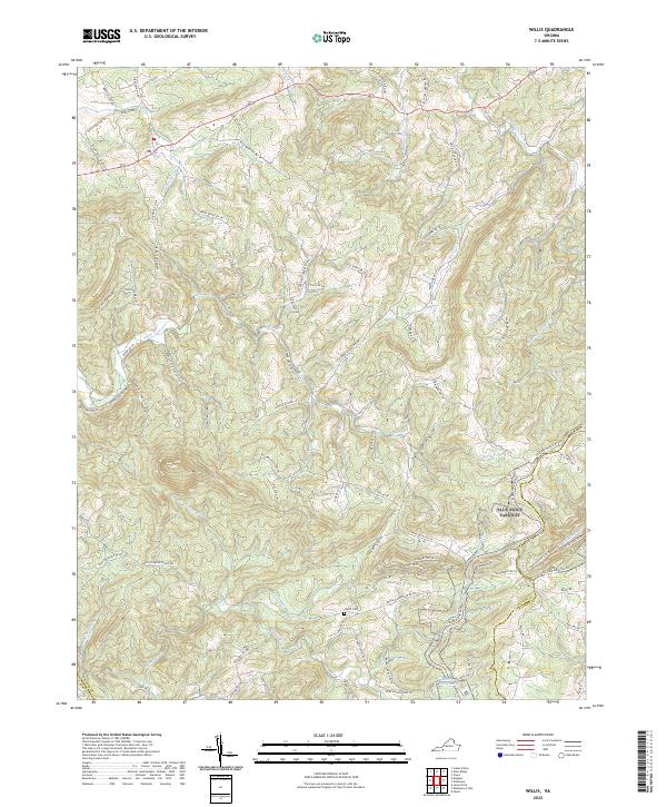
2022 Map of Willis
USGS Topo · Published 2022About this map
Buffalo Mountain and the surrounding high ridges of the Blue Ridge define the landscape of this portion of Floyd and Patrick counties. The winding corridor of the Blue Ridge Parkway travels the southern ridges, providing access to landmarks like the Mabry Mill Pond and the headwaters of Rock Castle Cr. Local history is preserved in sites such as the Shelor Cem, while the agrarian and early industrial roots of the region are reflected in roads like Willis Mill Rd NW. A complex network of drainage basins is visible, with the W Fork Little River and numerous forks like Burks Fork and Greasy Cr carving through the steep topography. This modern survey illustrates how the natural terrain and historic travel routes continue to shape settlement patterns near the county line.
Find a feature on this map
91 named features on this map. Tap any name to fly to it.
Don’t see what you’re looking for? This feature index may not catch every label — zoom into the map to look around manually.
Map Details
Editions of this 2022 Willis Map
This is the sole edition of this map. No revisions or reprints were ever made.
Other maps of this area

1889 · Hillsville
USGS Topo · 1:125,000

1892 · Hillsville
USGS Topo · 1:125,000

1896 · Hillsville
USGS Topo · 1:125,000

1928 · Stuart
USGS Topo · 1:48,000

1931 · Stuart
USGS Topo · 1:62,500

1953 · Winston-Salem
USGS Topo · 1:250,000

1955 · Winston-Salem
USGS Topo · 1:250,000

1956 · Macks Mountain
USGS Topo · 1:62,500

1957 · Mount Airy
USGS Topo · 1:62,500

1957 · Floyd
USGS Topo · 1:62,500