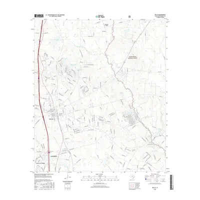
2016 Map of Willis
USGS Topo · Published 2016About this map
Willis and the northern outskirts of Conroe anchor this 2016 survey, reflecting the residential expansion through Montgomery County's piney woods. The landscape is characterized by numerous subdivisions and planned communities centered around small water bodies like Dunwoody Lake, Frontier Lake, and Panorama Lake. These developments are woven into the terrain between the Sam Houston National Forest and the Interstate 45 corridor, showing the modern suburban character of the region.
Find a feature on this map
196 named features on this map. Tap any name to fly to it.
Don’t see what you’re looking for? This feature index may not catch every label — zoom into the map to look around manually.
Map Details
Editions of this 2016 Willis Map
This is the sole edition of this map. No revisions or reprints were ever made.
Other maps of this area

1954 · Beaumont
USGS Topo · 1:250,000

1957 · Beaumont
USGS Topo · 1:250,000

1958 · Conroe
USGS Topo · 1:24,000

1958 · Cowl Spur
USGS Topo · 1:24,000

1958 · Lake Paula
USGS Topo · 1:24,000

1959 · Moore Grove
USGS Topo · 1:24,000

1959 · Cut and Shoot
USGS Topo · 1:24,000

1959 · Conroe NE
USGS Topo · 1:24,000

1960 · Willis
USGS Topo · 1:24,000

1960 · Maynard
USGS Topo · 1:24,000