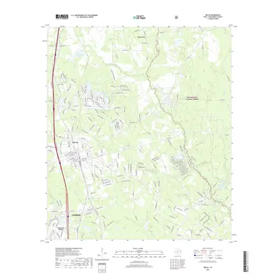
2019 Map of Willis
USGS Topo · Published 2019About this map
The settlement of Willis serves as a central hub on this Montgomery County landscape, situated just north of Conroe and the growing community of Panorama Village. The terrain is characterized by a dense network of water bodies and drainage systems, including Clifton Lake, Price Lake, and the distinctively numbered Lake Arrowhead Number 2 and Lake Arrowhead Number 3. To the northeast, the rural community of Mount Zion sits near the upper reaches of Fish Lake.
Find a feature on this map
204 named features on this map. Tap any name to fly to it.
Don’t see what you’re looking for? This feature index may not catch every label — zoom into the map to look around manually.
Map Details
Editions of this 2019 Willis Map
This is the sole edition of this map. No revisions or reprints were ever made.
Other maps of this area

1954 · Beaumont
USGS Topo · 1:250,000

1957 · Beaumont
USGS Topo · 1:250,000

1958 · Conroe
USGS Topo · 1:24,000

1958 · Cowl Spur
USGS Topo · 1:24,000

1958 · Lake Paula
USGS Topo · 1:24,000

1959 · Moore Grove
USGS Topo · 1:24,000

1959 · Cut and Shoot
USGS Topo · 1:24,000

1959 · Conroe NE
USGS Topo · 1:24,000

1960 · Willis
USGS Topo · 1:24,000

1960 · Maynard
USGS Topo · 1:24,000