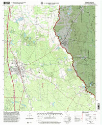
1997 Map of Willis
USGS Topo · Published 2000About this map
Willis serves as the focal point of this Montgomery County landscape, showcasing a mix of municipal development and natural forest land during the late 1990s. The town's layout includes civic markers such as Turner High School and a Racetrack, while the eastern portion of the map is dominated by the dense canopy of the Sam Houston National Forest. A complex network of creeks, including Little Caney Creek and Stewarts Creek, defines the local drainage, supporting smaller settlements like Esperanza.
Find a feature on this map
31 named features on this map. Tap any name to fly to it.
Don’t see what you’re looking for? This feature index may not catch every label — zoom into the map to look around manually.
Map Details
Editions of this 1997 Willis Map
This is the sole edition of this map. No revisions or reprints were ever made.
Other maps of this area

1954 · Beaumont
USGS Topo · 1:250,000

1957 · Beaumont
USGS Topo · 1:250,000

1958 · Conroe
USGS Topo · 1:24,000

1958 · Cowl Spur
USGS Topo · 1:24,000

1958 · Lake Paula
USGS Topo · 1:24,000

1959 · Moore Grove
USGS Topo · 1:24,000

1959 · Cut and Shoot
USGS Topo · 1:24,000

1959 · Conroe NE
USGS Topo · 1:24,000

1960 · Willis
USGS Topo · 1:24,000

1960 · Maynard
USGS Topo · 1:24,000