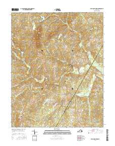
2016 Map of Willis Mountain
USGS Topo · Published 2016About this map
Willis Mountain stands as a prominent landmark in this central Virginia landscape, overlooking the surrounding communities of Pleasant Valley and Curdsville. The area is defined by a dense network of waterways, including the winding Willis River and the Little Willis River, which drain the lowlands between Buckingham and Cumberland counties. The map reflects a deeply rooted rural geography where historic transit corridors like Stage Coach Rd and Old Curdsville Rd continue to shape local movement.
Find a feature on this map
72 named features on this map. Tap any name to fly to it.
Don’t see what you’re looking for? This feature index may not catch every label — zoom into the map to look around manually.
Map Details
Editions of this 2016 Willis Mountain Map
This is the sole edition of this map. No revisions or reprints were ever made.
Other maps of this area

1891 · Palmyra
USGS Topo · 1:125,000

1891 · Farmville
USGS Topo · 1:125,000

1892 · Buckingham
USGS Topo · 1:125,000

1892 · Appomattox
USGS Topo · 1:125,000

1893 · Farmville
USGS Topo · 1:125,000

1895 · Palmyra
USGS Topo · 1:125,000

1897 · Palmyra
USGS Topo · 1:125,000

1947 · Roanoke
USGS Topo · 1:250,000

1950 · Dillwyn
USGS Topo · 1:62,500

1958 · Farmville
USGS Topo · 1:62,500