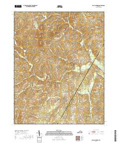
2019 Map of Willis Mountain
USGS Topo · Published 2019About this map
Willis Mtn rises as a prominent landmark in this central Virginia landscape, anchoring a region defined by the winding paths of the Willis River and the Little Willis River. Small settlements such as Curdsville, Pleasant Valley, and Sheppards are scattered across the terrain, connected by historical corridors like Plank Rd and Old Curdsville Rd. This mapping of the Buckingham County and Cumberland County border area reveals a deep-rooted rural character, where family and community history is preserved at Smyrna Cem, Mount Nebo Cem, and Salem Cem. The drainage patterns of Tongue Quarter Cr and Cattail Cr illustrate the complex watershed that has shaped local agriculture and land use for generations. This 2019 data provides a contemporary view of these longstanding Piedmont communities and their natural boundaries.
Find a feature on this map
71 named features on this map. Tap any name to fly to it.
Don’t see what you’re looking for? This feature index may not catch every label — zoom into the map to look around manually.
Map Details
Editions of this 2019 Willis Mountain Map
This is the sole edition of this map. No revisions or reprints were ever made.
Other maps of this area

1891 · Palmyra
USGS Topo · 1:125,000

1891 · Farmville
USGS Topo · 1:125,000

1892 · Buckingham
USGS Topo · 1:125,000

1892 · Appomattox
USGS Topo · 1:125,000

1893 · Farmville
USGS Topo · 1:125,000

1895 · Palmyra
USGS Topo · 1:125,000

1897 · Palmyra
USGS Topo · 1:125,000

1947 · Roanoke
USGS Topo · 1:250,000

1950 · Dillwyn
USGS Topo · 1:62,500

1958 · Farmville
USGS Topo · 1:62,500