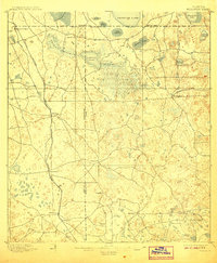
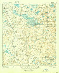
1895 Map of Williston
USGS Topo · Published 1907About this map
Williston and the neighboring settlements of Montbrook and Morriston serve as the primary hubs in this late-19th-century survey of North Central Florida. The landscape is defined by its industrial character, notably the presence of the Standard Mine and the village of Phosphate, which highlight the region's importance to the early mining economy. Transportation is anchored by the Florida Central and Peninsular R. R. and the dedicated Eagle Mine Br. line, illustrating the rail-driven movement of minerals and goods between the three counties of Alachua, Levy, and Marion.
Find a feature on this map
34 named features on this map. Tap any name to fly to it.
Don’t see what you’re looking for? This feature index may not catch every label — zoom into the map to look around manually.
Map Details
Editions of this 1895 Williston Map
6 editions found
Other maps of this area

1890 · Arredondo
USGS Topo · 1:62,500

1892 · Dunnellon
USGS Topo · 1:62,500

1892 · Arredondo
USGS Topo · 1:62,500

1893 · Citra
USGS Topo · 1:62,500

1894 · Dunnellon
USGS Topo · 1:62,500

1894 · Arredondo
USGS Topo · 1:62,500

1895 · Williston
USGS Topo · 1:62,500

1895 · Citra
USGS Topo · 1:62,500

1895 · Ocala
USGS Topo · 1:62,500

1938 · Hawthorn
USGS Topo · 1:48,000