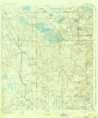
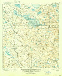
1895 Map of Williston
USGS Topo · Published 1935About this map
Williston stands at the crossroads of a developing transportation and extraction economy in north-central Florida during the late nineteenth century. Surveyed in 1893, this landscape is defined by its unique limestone prairie topography, including expansive areas like Priest Prairie, Fish Prairie, and Church Prairie. The Florida Central and Peninsular R. R. and the League Line B. R. R. anchor the region's commerce, connecting settlements such as Montbrook, Morriston, and Flemington.
Find a feature on this map
34 named features on this map. Tap any name to fly to it.
Don’t see what you’re looking for? This feature index may not catch every label — zoom into the map to look around manually.
Map Details
Editions of this 1895 Williston Map
6 editions found
Other maps of this area

1890 · Arredondo
USGS Topo · 1:62,500

1892 · Dunnellon
USGS Topo · 1:62,500

1892 · Arredondo
USGS Topo · 1:62,500

1893 · Citra
USGS Topo · 1:62,500

1894 · Dunnellon
USGS Topo · 1:62,500

1894 · Arredondo
USGS Topo · 1:62,500

1895 · Williston
USGS Topo · 1:62,500

1895 · Citra
USGS Topo · 1:62,500

1895 · Ocala
USGS Topo · 1:62,500

1938 · Hawthorn
USGS Topo · 1:48,000