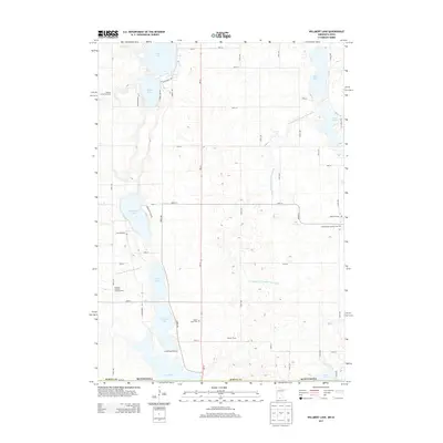
2013 Map of Willmert Lake
USGS Topo · Published 2013About this map
Willmert Lake and a series of interconnected glacial basins dominate this southern Martin County landscape along the Iowa-Minnesota border. The 2013 survey illustrates a region defined by its water management and agricultural heritage, where traditional farms like Neusch Farms and specialized operations such as Timberlake Orchards sit among a complex network of man-made drainage systems. Significant engineering is evident in the Judicial Ditch Number Ninetyeight and County Ditch Number Nine, which regulate the flow between major bodies like Amber Lake and N Silver Lake. Local history is anchored by several rural burial grounds including Oakwood Cem and Holy Family Catholic Cem, while recreation centers on the Dawsons Lakeside Campgrounds and the Rolling Green Fairways near the northern lakeshore.
Find a feature on this map
52 named features on this map. Tap any name to fly to it.
Don’t see what you’re looking for? This feature index may not catch every label — zoom into the map to look around manually.
Map Details
Editions of this 2013 Willmert Lake Map
This is the sole edition of this map. No revisions or reprints were ever made.
Other maps of this area

1954 · Fairmont
USGS Topo · 1:250,000

1958 · Fairmont
USGS Topo · 1:250,000

1967 · East Chain
USGS Topo · 1:24,000

1967 · Wilmert Lake
USGS Topo · 1:24,000

1967 · Granada
USGS Topo · 1:24,000

1967 · Fairmont
USGS Topo · 1:24,000

1970 · Welcome
USGS Topo · 1:24,000

1970 · Wilbert
USGS Topo · 1:24,000

1980 · Armstrong
USGS Topo · 1:24,000

1980 · Swea City
USGS Topo · 1:24,000