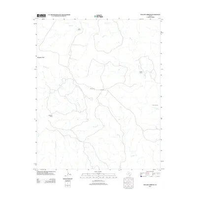
2012 Map of Willow Arroyo
USGS Topo · Published 2012About this map
Woodburn Place and several remote outposts define this high-plains landscape in Briscoe County, where the drainage network of the Texas Panhandle carves deep into the terrain. The map detail centers on the namesake Willow Arroyo and the winding course of Battle Cr, which is fed by Lone Tree Cr as it flows toward the eastern edge of the quadrangle. This area represents a rugged ranching and hunting environment, marked by seasonal camps such as Hackberry Camp and Timber Lake Camp rather than traditional town centers.
Find a feature on this map
12 named features on this map. Tap any name to fly to it.
Don’t see what you’re looking for? This feature index may not catch every label — zoom into the map to look around manually.
Map Details
Editions of this 2012 Willow Arroyo Map
This is the sole edition of this map. No revisions or reprints were ever made.
Other maps of this area

1954 · Plainview
USGS Topo · 1:250,000

1958 · Plainview
USGS Topo · 1:250,000

1960 · Indian Peak
USGS Topo · 1:62,500

1960 · Brice
USGS Topo · 1:62,500

1963 · Paloduro
USGS Topo · 1:24,000

1963 · Tate Arroyo
USGS Topo · 1:24,000

1963 · Clarendon SW
USGS Topo · 1:24,000
1976 · Indian Peak SW
USGS Topo · 1:24,000

1976 · Brice NW
USGS Topo · 1:24,000
1976 · Indian Peak NW
USGS Topo · 1:24,000