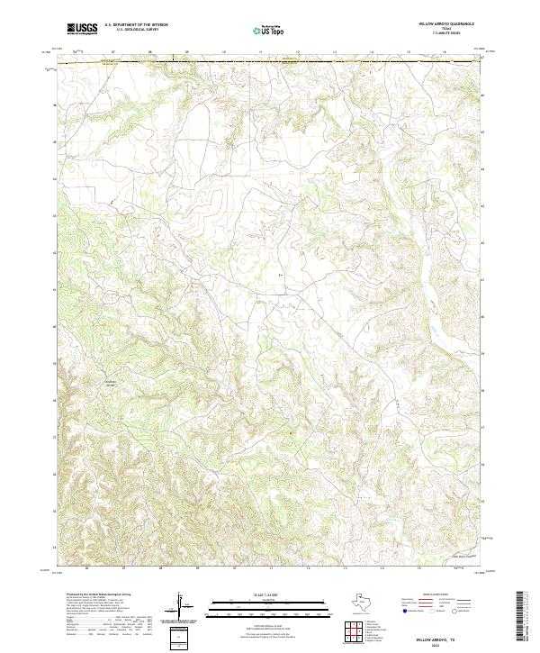
2022 Map of Willow Arroyo
USGS Topo · Published 2022About this map
Palo Duro Canyon carves into the southeastern corner of this landscape, marking a dramatic geological transition in the Texas Panhandle. This area is defined by the high plains topography of Stinkhole Divide, where the drainage patterns of several intermittent creeks originate. Watercourses including Battle Cr, Lone Tree Cr, and the sprawling network of Hackberry Cr illustrate the erosional forces that have shaped this portion of Briscoe County. The map details the intersection of Briscoe, Armstrong, and Donley counties, showing a sparsely populated territory where Co RD 55 serves as one of the few named terrestrial connections across the rolling terrain. The intricate contour lines reveal the complex finger-like draws and ridges that feed into the larger canyon system to the south and east.
Find a feature on this map
10 named features on this map. Tap any name to fly to it.
Don’t see what you’re looking for? This feature index may not catch every label — zoom into the map to look around manually.
Map Details
Editions of this 2022 Willow Arroyo Map
This is the sole edition of this map. No revisions or reprints were ever made.
Other maps of this area

1954 · Plainview
USGS Topo · 1:250,000

1958 · Plainview
USGS Topo · 1:250,000

1960 · Indian Peak
USGS Topo · 1:62,500

1960 · Brice
USGS Topo · 1:62,500

1963 · Paloduro
USGS Topo · 1:24,000

1963 · Tate Arroyo
USGS Topo · 1:24,000

1963 · Clarendon SW
USGS Topo · 1:24,000
1976 · Indian Peak SW
USGS Topo · 1:24,000

1976 · Brice NW
USGS Topo · 1:24,000
1976 · Indian Peak NW
USGS Topo · 1:24,000