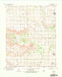
1961 Map of Willow
USGS Topo · Published 1978About this map
Haystack Mountain rises prominently above the southwestern Oklahoma landscape, providing a landmark for the rural communities of Greer and Beckham counties in the early 1960s. The North Fork Red River meanders through the eastern portion of the map, defining the local geography alongside numerous tributaries like Haystack Creek and Turkey Creek. This era reveals an established agricultural and resource-extraction economy, marked by scattered oil and gas wells and the Missouri Kansas Texas railroad line connecting settlements such as Willow and Brinkman. Genealogists will find significant value in the documentation of numerous family and community landmarks, including Carter Cem, Delhi Cems, and Plainview Cem, alongside local spiritual centers like Deer Creek Ch and Spring Creek Ch. Small town centers like Delhi and Moravia appear alongside evidence of local infrastructure, such as the Waterworks and the nearby Sayre Airfield transition.
Find a feature on this map
43 named features on this map. Tap any name to fly to it.
Don’t see what you’re looking for? This feature index may not catch every label — zoom into the map to look around manually.
Map Details
Editions of this 1961 Willow Map
2 editions found
Other maps of this area

1955 · Lawton
USGS Topo · 1:250,000

1955 · Clinton
USGS Topo · 1:250,000

1957 · Clinton
USGS Topo · 1:250,000

1960 · Sweetwater
USGS Topo · 1:62,500

1960 · Sayre
USGS Topo · 1:62,500

1961 · Willow
USGS Topo · 1:62,500

1961 · Erick
USGS Topo · 1:62,500

1961 · Retrop
USGS Topo · 1:62,500

1961 · Elk City
USGS Topo · 1:62,500

1971 · Mangum North
USGS Topo · 1:24,000