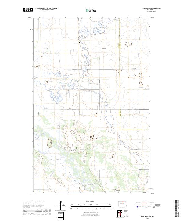
2024 Map of Willow City SW
USGS Topo · Published 2024About this map
The Souris River meanders through the heart of this North Dakota landscape, anchoring the conservation lands of the J. Clark Salyer National Wildlife Refuge. This modern survey reveals a landscape where water and wetlands dictate the pattern of human presence, as tributaries like Willow Creek and Snake Creek wind across the McHenry and Bottineau county line. The map identifies the historic Cole Ford river crossing, a site that suggests the importance of early transit routes through the river valley. Local heritage is preserved at the Immanuel Lutheran Cem, situated along 6th Ave NE. The area remains defined by its section-line road network, including routes like Co Hwy 17 and Co Rd 51, which provide access to the vast riparian ecosystems and the agricultural tracts that border them.
Find a feature on this map
28 named features on this map. Tap any name to fly to it.
Don’t see what you’re looking for? This feature index may not catch every label — zoom into the map to look around manually.
Map Details
Editions of this 2024 Willow City SW Map
This is the sole edition of this map. No revisions or reprints were ever made.
Other maps of this area

1949 · Bantry
USGS Topo · 1:24,000

1950 · Towner NW
USGS Topo · 1:24,000

1950 · Upham SE
USGS Topo · 1:24,000

1950 · Willow City SW
USGS Topo · 1:24,000

1950 · Bantry
USGS Topo · 1:24,000

1954 · Towner NE
USGS Topo · 1:24,000

1954 · Omemee
USGS Topo · 1:24,000

1954 · Gardena
USGS Topo · 1:24,000

1954 · Willow City
USGS Topo · 1:24,000

1954 · Minot
USGS Topo · 1:250,000