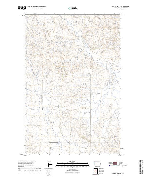
2024 Map of Willow Creek East
USGS Topo · Published 2024About this map
Willow Creek meanders through the heart of this Mercer County landscape, providing the primary drainage for a region defined by its traditional township and range grid. The drainage patterns of Elm Creek and Gold Creek further influence the topography, which is etched with a network of secondary roads and local routes like 73rd Ave SW and 22nd St SW. This survey reveals a classic North Dakota rural structure, where the intersection of county roads such as Co Rd 14 and Co Rd 16 serves as the backbone for the agricultural community. The map preserves the exact placement of local connectors like 75 1/2 Ave SW, reflecting the precise organization of the High Plains landscape in the early 21st century.
Find a feature on this map
23 named features on this map. Tap any name to fly to it.
Don’t see what you’re looking for? This feature index may not catch every label — zoom into the map to look around manually.
Map Details
Editions of this 2024 Willow Creek East Map
This is the sole edition of this map. No revisions or reprints were ever made.
Other maps of this area

1953 · Dickinson
USGS Topo · 1:250,000

1953 · Watford City
USGS Topo · 1:250,000

1954 · Bismarck
USGS Topo · 1:250,000

1954 · McClusky
USGS Topo · 1:250,000

1957 · Dickinson
USGS Topo · 1:250,000

1957 · Watford City
USGS Topo · 1:250,000

1958 · Bismarck
USGS Topo · 1:250,000

1958 · McClusky
USGS Topo · 1:250,000

1967 · Watford City
USGS Topo · 1:250,000

1968 · Medicine Butte
USGS Topo · 1:24,000