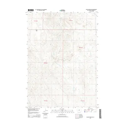
2015 Map of Willow Creek NW
USGS Topo · Published 2015About this map
Taka'a Okute Wakpa winds through this 2015 landscape, showcasing the hydrology of the northern Great Plains on the Pine Ridge Reservation. This topographic survey captures the natural drainage systems of the Middle Fork Willow Cr and E Fork Willow Cr as they cut through the upland terrain. A prominent landmark is the Squaw Humper Table, a high plateau that dominates the northwestern portion of the sheet. The only primary transportation route indicated is Bia-2, which crosses the northern half of the quadrangle. This map is particularly valuable for its recording of Indigenous hydronyms alongside conventional descriptive stream names, illustrating the cultural and administrative geography of Oglala Lakota County in the early 21st century.
Find a feature on this map
11 named features on this map. Tap any name to fly to it.
Don’t see what you’re looking for? This feature index may not catch every label — zoom into the map to look around manually.
Map Details
Editions of this 2015 Willow Creek NW Map
This is the sole edition of this map. No revisions or reprints were ever made.
Other maps of this area

1894 · Hermosa
USGS Topo · 1:125,000

1896 · Oelrichs
USGS Topo · 1:125,000

1900 · Oelrichs
USGS Topo · 1:125,000

1901 · Hermosa
USGS Topo · 1:125,000

1951 · Fairburn SE
USGS Topo · 1:24,000

1951 · Willow Creek NW
USGS Topo · 1:24,000

1951 · Willow Creek NE
USGS Topo · 1:24,000

1951 · Red Shirt SW
USGS Topo · 1:24,000

1951 · Smithwick NE
USGS Topo · 1:24,000

1951 · Cuny Table West
USGS Topo · 1:24,000