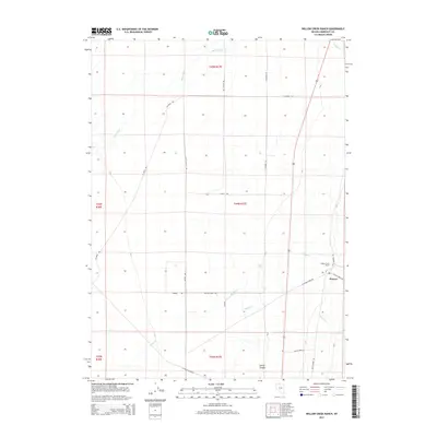
2015 Map of Willow Creek Ranch
USGS Topo · Published 2015About this map
The Quinn River meanders through this portion of the northern Nevada desert, defining the arid landscape of Humboldt County in the mid-2010s. The settlement of Platora and the Willow Creek Ranch serve as primary points of human activity in an area otherwise dominated by a grid of rural routes and natural drainage systems. Water courses including Willow Cr, Eagle Cr, and Skull Cr descend from higher elevations toward the valley floor, carving out features like Spring Canyon. The map details a complex network of local infrastructure, from the well-traveled Old Highway 95 to specifically named access ways such as Porter Rd and N Rebel Creek Rd, illustrating the intersection of ranching interests and public land management.
Find a feature on this map
23 named features on this map. Tap any name to fly to it.
Don’t see what you’re looking for? This feature index may not catch every label — zoom into the map to look around manually.
Map Details
Editions of this 2015 Willow Creek Ranch Map
This is the sole edition of this map. No revisions or reprints were ever made.
Other maps of this area

1882 · Paradise
USGS Topo · 1:250,000

1893 · Paradise
USGS Topo · 1:250,000

1955 · McDermitt
USGS Topo · 1:250,000

1959 · McDermitt
USGS Topo · 1:250,000

1959 · Orovada
USGS Topo · 1:62,500

1959 · McDermitt
USGS Topo · 1:62,500

1959 · Hinkey Summit
USGS Topo · 1:62,500

1959 · Jordan Meadow
USGS Topo · 1:62,500

1985 · Quinn River Valley
USGS Topo · 1:100,000
1991 · Hoppin Peaks
USGS Topo · 1:24,000