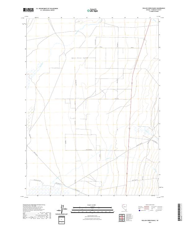
2021 Map of Willow Creek Ranch
USGS Topo · Published 2021About this map
Quinn River Valley defines this section of northern Humboldt County, where the Quinn River meanders across a wide basin punctuated by ephemeral drainage systems. The landscape is structured by a network of ranching and access roads, including Home Ranch RD, Upper Snapp RD, and Lower Snap Field RD, reflecting the area's agricultural and pastoral utility. Several minor waterways, such as Willow Cr, Eagle Cr, and Skull Cr, emerge from the surrounding higher ground to feed into the valley floor.
Find a feature on this map
27 named features on this map. Tap any name to fly to it.
Don’t see what you’re looking for? This feature index may not catch every label — zoom into the map to look around manually.
Map Details
Editions of this 2021 Willow Creek Ranch Map
This is the sole edition of this map. No revisions or reprints were ever made.
Other maps of this area

1882 · Paradise
USGS Topo · 1:250,000

1893 · Paradise
USGS Topo · 1:250,000

1955 · McDermitt
USGS Topo · 1:250,000

1959 · McDermitt
USGS Topo · 1:250,000

1959 · Orovada
USGS Topo · 1:62,500

1959 · McDermitt
USGS Topo · 1:62,500

1959 · Hinkey Summit
USGS Topo · 1:62,500

1959 · Jordan Meadow
USGS Topo · 1:62,500

1985 · Quinn River Valley
USGS Topo · 1:100,000
1991 · Hoppin Peaks
USGS Topo · 1:24,000