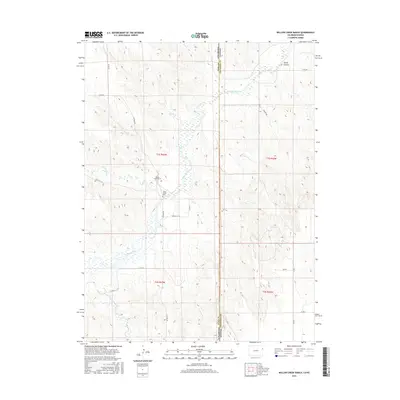
2016 Map of Willow Creek Ranch
USGS Topo · Published 2016About this map
The Arikaree River meanders across the high plains of the Colorado-Kansas border, carving a riparian corridor through a landscape defined by ranching and wide-open rangeland. This 2016 survey highlights the sparse, rural infrastructure of the region, where the Willow Creek Ranch serves as a primary local landmark. A notable site for genealogists and local historians is the Jones Family Cem, a small burial ground situated near the riverbanks that speaks to the deep-rooted heritage of early settlers in this arid environment.
Find a feature on this map
24 named features on this map. Tap any name to fly to it.
Don’t see what you’re looking for? This feature index may not catch every label — zoom into the map to look around manually.
Map Details
Editions of this 2016 Willow Creek Ranch Map
This is the sole edition of this map. No revisions or reprints were ever made.
Other maps of this area

1942 · St. Francis
USGS Topo · 1:62,500

1943 · St. Francis
USGS Topo · 1:62,500

1951 · St Francis
USGS Topo · 1:62,500

1954 · Limon
USGS Topo · 1:250,000

1954 · Sterling
USGS Topo · 1:250,000

1954 · McCook
USGS Topo · 1:250,000

1954 · Goodland
USGS Topo · 1:250,000

1956 · Goodland
USGS Topo · 1:250,000

1957 · McCook
USGS Topo · 1:250,000

1957 · Limon
USGS Topo · 1:250,000