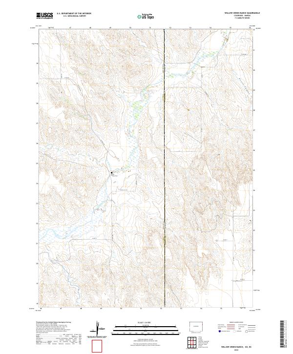
2022 Map of Willow Creek Ranch
USGS Topo · Published 2022About this map
The Arikaree River carves a winding path through the high plains along the Colorado-Kansas border, defining a landscape of wide riverbeds and shifting seasonal hydrology. This high-altitude prairie is marked by the rugged incision of Devils Canyon and the confluence of several intermittent tributaries, including Horse Cr and Dry Willow Cr. The map captures a transition point between Yuma County, Colorado, and Cheyenne County, Kansas, where the survey lines of t1s r42w and t2s r42w organize the vast open range. Cultural footprints are sparse but significant for local history, notably the Jones Family Cem, which sits near the banks of the river. The area is served by a geometric grid of rural routes such as Co RD 2 and Airport Rd, reflecting the modern agricultural and ranching infrastructure that sustains this borderland.
Find a feature on this map
22 named features on this map. Tap any name to fly to it.
Don’t see what you’re looking for? This feature index may not catch every label — zoom into the map to look around manually.
Map Details
Editions of this 2022 Willow Creek Ranch Map
This is the sole edition of this map. No revisions or reprints were ever made.
Other maps of this area

1942 · St. Francis
USGS Topo · 1:62,500

1943 · St. Francis
USGS Topo · 1:62,500

1951 · St Francis
USGS Topo · 1:62,500

1954 · Limon
USGS Topo · 1:250,000

1954 · Sterling
USGS Topo · 1:250,000

1954 · McCook
USGS Topo · 1:250,000

1954 · Goodland
USGS Topo · 1:250,000

1956 · Goodland
USGS Topo · 1:250,000

1957 · McCook
USGS Topo · 1:250,000

1957 · Limon
USGS Topo · 1:250,000