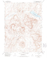
1965 Map of Willow Creek Reservoir
USGS Topo · Published 1988About this map
Willow Creek Reservoir dominates the northeastern corner of this Elko County landscape, where the high desert terrain is defined by a network of drainage systems and isolated peaks. Centrally located, Big Butte rises as a prominent landmark overlooking the confluence of varied water sources, including Ivanhoe Creek and North Antelope Creek. The 1960s survey captures a working landscape of mineral extraction and livestock management, indicated by the presence of several mining operations and fine dashed lines marking selected fences.
Find a feature on this map
17 named features on this map. Tap any name to fly to it.
Don’t see what you’re looking for? This feature index may not catch every label — zoom into the map to look around manually.
Map Details
Editions of this 1965 Willow Creek Reservoir Map
2 editions found
Other maps of this area

1955 · McDermitt
USGS Topo · 1:250,000

1956 · Mt. Blitzen
USGS Topo · 1:62,500

1959 · McDermitt
USGS Topo · 1:250,000

1965 · Willow Creek Reservoir
USGS Topo · 1:24,000

1965 · Squaw Valley Ranch
USGS Topo · 1:24,000

1965 · Rock Creek Ranch
USGS Topo · 1:24,000
1965 · Willow Creek Reservoir SE
USGS Topo · 1:24,000
1970 · China Camp
USGS Topo · 1:24,000
1970 · Santa Renia Fields
USGS Topo · 1:24,000

1973 · Little Rock Creek
USGS Topo · 1:24,000