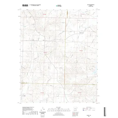
2020 Map of Willow
USGS Topo · Published 2020About this map
Rolla and Lono anchor this landscape where Hot Spring, Grant, and Dallas counties converge. The terrain is defined by a dense network of timber access roads and creeks, including L'Eau Frais Cr and Cypress Cr. Local history is preserved in family and community burial grounds such as Gray Cem, Phillips Cem, and Lono Cem. To the east, Cox Creek Lake provides a significant water feature near the Grant County line.
Find a feature on this map
74 named features on this map. Tap any name to fly to it.
Don’t see what you’re looking for? This feature index may not catch every label — zoom into the map to look around manually.
Map Details
Editions of this 2020 Willow Map
This is the sole edition of this map. No revisions or reprints were ever made.
Other maps of this area

1948 · Malvern
USGS Topo · 1:62,500

1949 · Malvern
USGS Topo · 1:62,500

1955 · Little Rock
USGS Topo · 1:250,000

1956 · Little Rock
USGS Topo · 1:250,000

1960 · Little Rock
USGS Topo · 1:250,000

1963 · Prattsville
USGS Topo · 1:24,000

1964 · Poyen
USGS Topo · 1:24,000

1964 · Little Rock
USGS Topo · 1:250,000

1965 · Round Hill
USGS Topo · 1:24,000
1965 · Leola
USGS Topo · 1:24,000