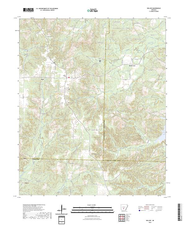
2024 Map of Willow
USGS Topo · Published 2024About this map
Lono and Rolla serve as the primary hubs in this timber-rich region where the borders of Hot Spring, Grant, and Dallas counties converge. The landscape is defined by an intricate network of waterways, including the winding L'Eau Frais Creek in the northwest and Guesses Creek to the southeast. Family history is anchored at Gray Cem, Phillips Cem, and Lono Cem, which are situated along rural corridors like Livingston RD and Mail Route Rd. The topography is shaped by countless small drainages feeding into larger systems like West Fork Tulip Creek, while the settlement of Willow marks the southwestern boundary. A notable concentration of forest roads, such as Forest RD 9303 and Forest RD 9002, reflects the area's ongoing relationship with the surrounding woodlands and rural access routes.
Find a feature on this map
74 named features on this map. Tap any name to fly to it.
Don’t see what you’re looking for? This feature index may not catch every label — zoom into the map to look around manually.
Map Details
Editions of this 2024 Willow Map
This is the sole edition of this map. No revisions or reprints were ever made.
Other maps of this area

1948 · Malvern
USGS Topo · 1:62,500

1949 · Malvern
USGS Topo · 1:62,500

1955 · Little Rock
USGS Topo · 1:250,000

1956 · Little Rock
USGS Topo · 1:250,000

1960 · Little Rock
USGS Topo · 1:250,000

1963 · Prattsville
USGS Topo · 1:24,000

1964 · Poyen
USGS Topo · 1:24,000

1964 · Little Rock
USGS Topo · 1:250,000

1965 · Round Hill
USGS Topo · 1:24,000
1965 · Leola
USGS Topo · 1:24,000