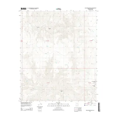
2014 Map of Willow Mountain SE
USGS Topo · Published 2014About this map
Cottonwood Spring serves as a vital water source in this corner of Graham County, where the landscape is defined by a complex network of drainages and canyons. The terrain transitions from the heights of Bull Canyon and Windy Bob Canyon in the north toward the southern reaches of Eagle Cr. Ranching and land management infrastructure is evident through numerous named water catchments such as Fourmile Tank, Night Trap Tank, and Burro Tank, which are essential for navigating this arid environment. The map details the winding paths of Cienega Cr and S Cienega Cr as they cut through the topography. In the east, the uniquely named East Fork Potato Patch Draw provides a specific landmark for local history and geographic orientation. Access is limited primarily to Bia-801, reflecting the area's controlled and utilitarian road network.
Find a feature on this map
20 named features on this map. Tap any name to fly to it.
Don’t see what you’re looking for? This feature index may not catch every label — zoom into the map to look around manually.
Map Details
Editions of this 2014 Willow Mountain SE Map
This is the sole edition of this map. No revisions or reprints were ever made.
Other maps of this area

1902 · Clifton
USGS Topo · 1:62,500

1913 · Morenci
USGS Topo · 1:125,000

1915 · Morenci
USGS Topo · 1:125,000

1954 · Clifton
USGS Topo · 1:250,000

1957 · Clifton
USGS Topo · 1:250,000

1958 · Clifton
USGS Topo · 1:250,000

1962 · Clifton
USGS Topo · 1:250,000

1962 · Clifton
USGS Topo · 1:62,500

1962 · Bryce Mountain
USGS Topo · 1:62,500

1967 · Robinson Mesa
USGS Topo · 1:24,000