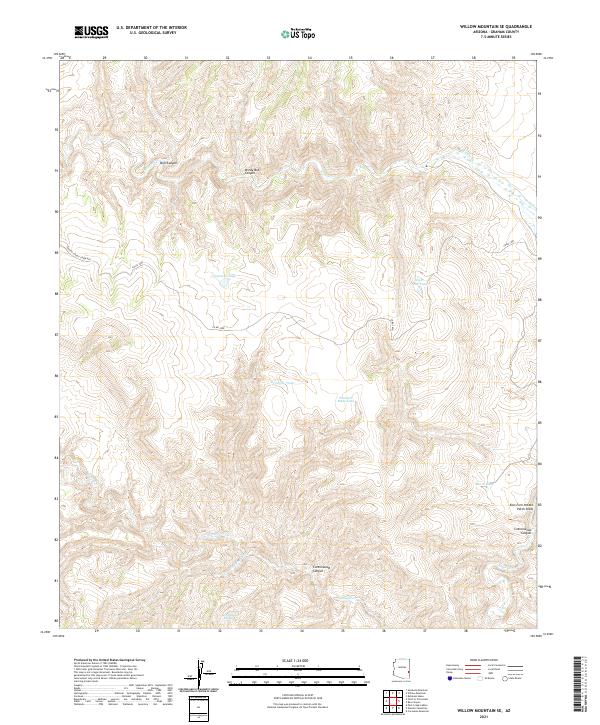
2021 Map of Willow Mountain SE
USGS Topo · Published 2021About this map
Willow Cr and Eagle Cr carve through this Graham County landscape, defining a network of drainages and canyons in the American Southwest. The terrain is marked by seasonal water sources and ranching infrastructure, including Fourmile Tank, Dry Trap Tank, and Night Trap Tank. These features suggest a history of livestock management in an arid environment where water is the primary geographic driver. Significant landforms like Bull Canyon and Windy Bob Canyon dominate the northern sections, while Cottonwood Canyon and the East Fork Potato Patch Draw characterize the south. Human transit through this area is largely limited to the 1800 Rd (Eagle Creek Rd), which provides access to the higher elevations and remote drainages like Cienega Cr.
Find a feature on this map
22 named features on this map. Tap any name to fly to it.
Don’t see what you’re looking for? This feature index may not catch every label — zoom into the map to look around manually.
Map Details
Editions of this 2021 Willow Mountain SE Map
This is the sole edition of this map. No revisions or reprints were ever made.
Other maps of this area

1902 · Clifton
USGS Topo · 1:62,500

1913 · Morenci
USGS Topo · 1:125,000

1915 · Morenci
USGS Topo · 1:125,000

1954 · Clifton
USGS Topo · 1:250,000

1957 · Clifton
USGS Topo · 1:250,000

1958 · Clifton
USGS Topo · 1:250,000

1962 · Clifton
USGS Topo · 1:250,000

1962 · Clifton
USGS Topo · 1:62,500

1962 · Bryce Mountain
USGS Topo · 1:62,500

1967 · Robinson Mesa
USGS Topo · 1:24,000